Day 6-8, (aug 12-14) miles 2229-2296
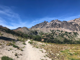
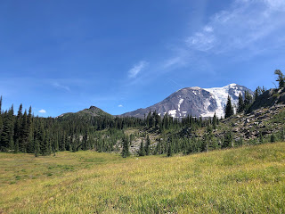
On day 6 I got back on trail after a relaxing time at Trout Lake. The day started with a climb up to the base of Mt Adams, with incredible views of Adams, Mt Hood, Mt St Helens, and Mt Rainier all at the same time. The trail went through some burn areas and then it was surrounded in beautiful alpine meadows with lots of of wildflowers. Up to this point the trail has been under a green tunnel of trees, but this was the day that it started to open out.
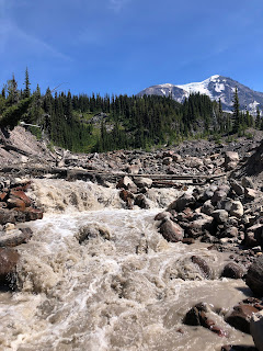
The milky Adams Creek required a bit of a ford, but with logs to hold onto it was easy. The trail began to descend from the mountain, and I set up camp at the bottom, mi 2250.5 for a total of 20.5 for the day. I hit mile 100 for Washington! The campsite was one of my favorites that I’ve ever had, as there was an awesome spring bubbling straight out from some lava rock. It was super cold clear water, and is the only kind of source that I would drink without a filter. What an introduction to the Goat Rocks! The morning of day 7 the trail climbed back up into alpine meadows and the trail opened into incredible views of rocky peaks. Just before Cispus pass the views totally changed and I saw some really cool six sided basalt rock formations apparently called “columnar jointing” according to a farout comment. It is formed by even and perfect cooling of the basalt, allowing for massive 6 sided columns to form.
There were many weekenders out hiking the last couple days, many with dogs. It was also the middle of a heat wave, but I was glad that I was going up to higher elevations to lessen the heat. I set up camp at mile 2274.6 for a 24.1 mile day.
On day 8 I climbed up toward the heights of the goat rocks. There where amazing views of Adams, St Helens, and Rainier all day long. I had to cross one super easy snow field just before the knife’s edge traverse, which was super easy. I took an alternate for one part to avoid a series of angled snowfields that didn’t look very fun, and I’m glad I did, as the alternate was so beautiful. It takes you up past the highest point on the pct in Washington, 7600’. After that I hiked down on the knife’s edge, a very narrow ridge line only a few feet wide in some points, beautiful alpine basins on both sides.
After a while the trail descends back down into forest before rising back up for the last climb of the day. I took a short alternate to Shoe Lake, a beautiful alpine lake that seemed easier to collect water from than some of the other sources on the climb. On the way toward White Pass I caught back up with Mark from Scotland, “Tubbs” as he is known now. He made me aware of a shortcut through the ski resort, saving a couple miles to make it to the convenience store before its closing. I’m not sure it saved as much time as I had hoped, but it was still fun hiking through all the ski lifts. I camped behind the White Pass Kracker Barrel, a very pct friendly place, mile 2295.9 for a 21.9 mile day.


Awesome photos Ian! Stay hydrated
ReplyDeletelove dad
So awesome 👍
ReplyDeleteBeautiful!
ReplyDeleteI have hiked all around that area and it was great to see your pictures and be able to identify where you were. Enjoy! Amazing country
ReplyDeleteLisa
Awesome
ReplyDeleteWhat beautiful photos, Ian! We love following along with you on your journey! ~ Chris Kindem and family
ReplyDelete